


Spring Grove Twp. Voting District, Houston County, Minnesota
About
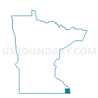
Outline

Summary
| Unique Area Identifier | 602500 |
| Name | Spring Grove Twp. Voting District |
| County | Houston County |
| State | Minnesota |
| Area (square miles) | 34.94 |
| Land Area (square miles) | 34.88 |
| Water Area (square miles) | 0.06 |
| % of Land Area | 99.83 |
| % of Water Area | 0.17 |
| Latitude of the Internal Point | 43.54019530 |
| Longtitude of the Internal Point | -91.68439740 |
Maps


Graphs
Select a template below for downloading or customizing gragh for Spring Grove Twp. Voting District, Houston County, Minnesota


Neighbors
Neighoring Voting District (by Name) Neighboring Voting District on the Map
- Black Hammer Twp. Voting District, Houston County, MN
- Caledonia Twp. Voting District, Houston County, MN
- HIGHLAND TWP Voting District, Winneshiek County, IA
- Newburg Twp. Voting District, Fillmore County, MN
- Preble Twp. Voting District, Fillmore County, MN
- Spring Grove Voting District, Houston County, MN
- WATERLOO TWP Voting District, Allamakee County, IA
- Wilmington Twp. Voting District, Houston County, MN
Top 10 Neighboring County Subdivision (by Population) Neighboring County Subdivision on the Map
- Spring Grove city, Houston County, MN (1,330)
- Caledonia township, Houston County, MN (641)
- Wilmington township, Houston County, MN (434)
- Spring Grove township, Houston County, MN (402)
- Newburg township, Fillmore County, MN (379)
- Waterloo township, Allamakee County, IA (266)
- Highland township, Winneshiek County, IA (254)
- Black Hammer township, Houston County, MN (245)
- Preble township, Fillmore County, MN (209)
Top 10 Neighboring Place (by Population) Neighboring Place on the Map
Top 10 Neighboring Unified School District (by Population) Neighboring Unified School District on the Map
- Decorah Community School District, IA (11,998)
- Allamakee Community School District, IA (8,992)
- Mabel-Canton Public School District, MN (2,475)
- Spring Grove School District, MN (2,228)
Top 10 Neighboring State Legislative District Lower Chamber (by Population) Neighboring State Legislative District Lower Chamber on the Map
Top 10 Neighboring State Legislative District Upper Chamber (by Population) Neighboring State Legislative District Upper Chamber on the Map
Top 10 Neighboring 111th Congressional District (by Population) Neighboring 111th Congressional District on the Map
Top 10 Neighboring Census Tract (by Population) Neighboring Census Tract on the Map
- Census Tract 209, Houston County, MN (3,883)
- Census Tract 9501, Winneshiek County, IA (3,614)
- Census Tract 9606, Fillmore County, MN (3,125)
- Census Tract 9602, Allamakee County, IA (2,591)